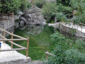
GPS coordinates: (40.7508022154818, -8.017482873213906)
On a walk in the late afternoon, on the road from Viseu to São Pedro do Sul, turn right to Lufinha. Just before reaching the village, there is a sign indicating the place. By foot, on the right, enter the forest. When the shadows of the sunset wash over the “Pedra da Cobra”, the spiral petroglyphs are drawn into the rock and the labyrinth appears in the granite stone.
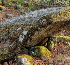
GPS coordinates: (40.70667046939478, -7.739341673469164)
Upon arrival, don’t hesitate to enter the chapel of Nossa Senhora da Esperança, built in the sec. XVIII and let yourself be surprised by the transition from the simplicity of the exterior architecture, to the exuberance of its interior: here multiple artistic languages are combined, the gilded and polychrome carving, the wooden sculptures, the painting, the perspective painting, the beautiful murals of baroque tiles of the body and of the chancel that portray scenes from the profane life, signed by Theotonio dos Santos – one of the renowned masters of the time (around 1730) – and lastly the organ, one of the national jewels. Visits are available every Friday, Saturday and Sunday, from 10 am to 12 pm and from 1:30 pm to 6 pm, or by appointment on the telephone +351 232 980 000.
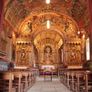
Gps Coordinates: (40.673211479341134, -7.804900702684527)
Engage in a forest where oaks predominate and discover the low falls of the Sátão River. Regain strength on the small river beach of the village and resume the path passing through the ruined manor house, the Casa do Cerrado de Viseu, which still holds its imposing coat of arms. Go up the road and finally, among the tall pine trees, go down the Roman path.
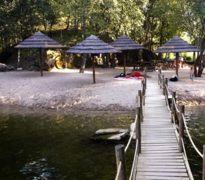
Gps Coordinates: (41.40921859553095, -8.362335328044567)
You can start the tour at Capela São João Francisco, in Aldeia de Várzea. Visit the Linen Museum before or after the walk. The walk is easy and pleasant. When you reach the river and after skipping through the 86 stones, go back. The walk is always along the stream. The setting is idyllic. The windmills will appear next to small waterfalls. When you reach the paved road, you can continue along the trail and go to the Calde dam by turning right, or return to the village turning left.

Gps Coordinates: (40.81597539796787, -8.228202598045844)
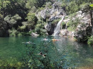
A few kilometers before reaching Manhouce, in Sernadinha there are already indications for Poço Negro. When you go down through the village, you will find a large field where you can park your car. Go on foot. From there, the road is unpaved and full of potholes. It’s only about 500 meters down (nothing to fear, down is the easiest way!). You’ll find Poço Negro in the background. Upon reaching the small picnic area, take the trail on the left. Keep going down, the well draws itself between the rocks and the vegetation. Downstairs, you won’t find a place to lay your towel, maybe just a corner of a stone to sit on. The best places will already be occupied by people there. Popular music can echo in the well’s throat – it doesn’t matter, just dive into the clear, cool waters of the Magic Mountains! And regain energy to climb the slope! If you have time, head to Manhouce. In the center of the village there is a café, sit under the fig tree and talk to local people. Nearby, you’ll make more discoveries, among waterfalls and wells, Poço da Cilha and others, there are plenty of options to choose from.
Gps Coordinates: (40.38513252309007, -7.697120070553012)
Head towards Seia and continue until you reach S. Romão (on the west slope of Serra da Estrela). Majestic, magnificent. Passing S. Romão, you will soon find directions to Lapa dos Dinheiros and its river beach. It is a swimming pool with natural, transparent and fresh water, with space to spread your towel. If you want, have a picnic, there are tables. Explore the surrounding area. There are places that will take your breath away. And then, if you have the afternoon free and feel like it, venture out and take the walk from there to the Horns of the Devil. Find out about the route, go and return. It is about 7 kilometers. At first you will be going up, but will quickly reach the top and your eyes will scan the hillside of the Serra and a deep valley of vegetation where in the summer the Caniça brook hides. Walk until the end of it, and you’ll find the Horns, on the right side. Go a little further, put your feet on the water and rest your thoughts in that gigantic scenery of water.
